| ||||||
Biological Recording in Argyll
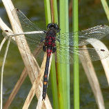
For biological recording purposes, Britain is divided into a number of regions each having their own Biological Records Centre. The Biological Records Centre for vice-county 98 "Main Argyll" was begun in 2012 by Lorn Natural History Group (LNHG), who continued to run the records centre until 2018. The records centre developed to the point where it needed to be established on an independent footing, and this was accomplished at the end of 2018 with the creation of Argyll Biological Records Centre (ABReC). ABReC continues to have close links with LNHG, and, as always, LNHG field trips will be an important source of records. Area of interest Argyll is a very extensive area with many islands and remote mainland regions. It would not be possible for a small team to cover all of it in a satisfactory way. In terms of Watsonian vice-counties, the standard geographical divisions used for biological recording, Argyll corresponds approximately to four of these: VC98 "Main Argyll" - Argyll mainland from Loch Leven in the north to the Crinan Canal in the south, and incorporating all of Cowal, The bounary then goes up Loch Long, over the summit of Ben Lui, encompasses the bulk of Rannoch Moor and then follows the Blackwater Reservoir and River Leven back to Loch Leven. VC98 also includes the islands of Lismore, Kerrera, Seil and Luing, and the smaller islands close to these or to the mainland. VC101 "Kintyre" - Kintyre and Knapdale south of the Crinan Canal VC102 "South Ebudes" - Islay, Jura, Colonsay and associated islands VC103 "Mid Ebudes" - Mull, Coll, Tiree and associated islands ABReC's principal field of operations will remain VC98. This is the area in which it will run field trips, fungal forays, moth trapping events etc etc, and attempt to record as comprehensively as possible by means of personal expeditions to all its far-flung corners. The Isle of Mull, in VC103, is also an ABReC core area and recording priority zone. ABReC, like LNHG before it, will act as a holding station for any parts of Argyll within VC's 101, 102 & 103 which don't yet have records centres. ABReC will encourage records, especially of under-recorded groups such as invertebrates and fungi, from such "orphan" areas within Argyll, while also giving all possible help and encouragement to anyone seeking to set up local records centres to cover those places and take them off our hands. The northernmost slice of VC98, comprising the Duror, Ballachulish and Glen Coe area, has traditionally been considered part of Argyll but is not currently within the Argyll & Bute Council area, and belongs instead to Highland Region. By agreement with Highland Biological Recording Group (HBRG), who cover the rest of Highland Region, ABReC will cover this area so that record centre boundaries are aligned with vice-county boundaries. Morvern has also been considered part of Argyll in the past, but we do not have any interest in that area. It is covered by HBRG. The Helensburgh and Lomond Area of Argyll and Bute Council is outside our area of interest. It belongs to vice-county 99 "Dunbartonshire" and is covered by Glasgow Museums Biological Records Centre. Please send any records from that area to biological.records@glasgowlife.org.uk What happens to the records The records in our database are placed on the National Biodiversity Network (NBN) and made available to Scottish Natural Heritage (SNH) and other statutory bodies, so that they can be taken into account when planning proposals are being considered or sites are assessed for environmental protection. We welcome all records no matter how common the species. The distribution maps for many species in Argyll are misleading due to the lack of data. This can only be corrected if people send in records of what they see. As well as placing the records on the NBN, we will pass them on to the relevant taxonomic recording scheme, e.g. Butterfly Conservation, British Dragonfly Society, Botanical Society of Britain and Ireland, etc. If you have already sent your records to one of these schemes it is still important to send a copy to your local records centre (that's us!) so that the records are available where needed. Many taxonomic recording schemes take years to put their records on the NBN, or do not do so at all. Environmental consultants do not approach all the dozens of different taxonomic recording schemes for data, they normally just ask the local records centre to supply the records they hold. If you are sending us records which you have already sent to a taxonomic recording scheme, then by informing us of this you can ensure that we don't re-send them to that particular scheme. Open data model ABReC adheres to the publicly-funded open-data model for record centres, as approved by SNH and recommended by the recently published Scottish Biodiversity Information Forum review This means that we make all our data, other than sensitive records, publicly available, and upload it to the NBN Atlas so that the records appear on the national distribution maps for each species. All the people who send us records want them to appear on maps and to be used to advance human knowledge of the natural world.
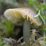
Hazel Gloves fungus, a speciality of the Atlantic hazelwoods on Argyll's west coast. Photo © Jan Hamilton.
|